
The Comprehensive Picture of Visiting Patagonia

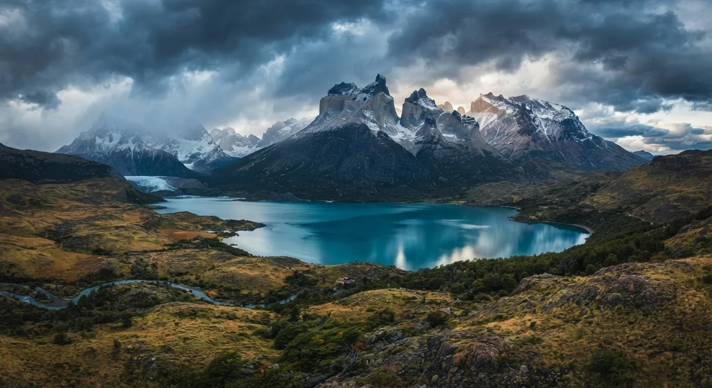
Photo: DockedReads.com | Information Made Easy editorial
Key Takeaways
- Patagonia spans both Argentina and Chile, and each side offers a distinct experience requiring separate planning.
- The primary trekking season runs from November through March, though weather is unpredictable year-round.
- Iconic trails like Torres del Paine's W Trek require advance reservations that often sell out months ahead.
- Getting between major Patagonian destinations involves long overland legs or domestic flights — budget time accordingly.
- Patagonia rewards preparation; improvised trips frequently run into accommodation, weather, or permit obstacles.
What Patagonia Actually Is
Patagonia is not a country, a national park, or a single defined region — it is a vast geographic concept covering the southern cone of South America, roughly from the Río Colorado in Argentina southward to Tierra del Fuego. Estimates of its total area vary, but most place it somewhere between 400,000 and 500,000 square miles, split between Argentina and Chile. Within that space you'll find Andean peaks, Patagonian steppe, temperate rainforest, glaciers, fjords, and some of the windiest terrain on the planet.
The name carries enormous romantic weight, partly because of the travel writing it has inspired and partly because it genuinely looks like nowhere else on Earth. But that mythology can obscure practical realities. Patagonia is remote, expensive relative to other South American destinations, logistically demanding, and climatically unforgiving. Understanding what it actually is — geographically and experientially — is the first step toward planning a trip that matches your expectations.
For context on how other dramatically different landscapes compare, the practical orientation to New Zealand offers a useful parallel: remote, scenically iconic, and requiring careful seasonal planning.
~500K sq mi
Estimated total area of Patagonia
Patagonia spans portions of both Argentina and Chile, making it one of the largest wilderness regions in the Southern Hemisphere.
4–5 days
Typical duration for the W Trek
The W Trek through Torres del Paine covers approximately 50 miles and is the most popular multi-day route in Chilean Patagonia.
Nov–Mar
Primary trekking season window
Austral summer brings longer daylight hours and more accessible trails, though wind and sudden weather changes remain constant factors.
Argentine vs. Chilean Patagonia
The Andes form a rough boundary between the two countries, and the differences in landscape, infrastructure, and visitor experience on each side are significant. Argentine Patagonia is broader and drier east of the mountains — the open steppe stretching toward the Atlantic is cattle and sheep country, punctuated by towns like Bariloche (a resort hub in the Lake District) and El Calafate (the gateway to Los Glaciares National Park and the famous Perito Moreno Glacier). The Argentine side also includes the Valdés Peninsula, a UNESCO-listed wildlife sanctuary in a completely different ecological zone.
Chilean Patagonia, by contrast, is wetter, wilder, and more compressed against the Pacific. Torres del Paine National Park — arguably the most photographed destination in all of Patagonia — sits in Chile's Magallanes region. The Chilean side also encompasses the Carretera Austral, an 800-mile unpaved highway running through remote fjordland and forest that has become a destination in its own right for cyclists and overlanders. Puerto Natales serves as the primary base for Torres del Paine trekkers.
Many visitors cross between both sides, which is straightforward at border crossings but adds complexity to routing. For anyone building a multi-country itinerary, the complete guide to planning a multi-destination trip addresses exactly the kind of cross-border logistics Patagonia demands.
When planning a route that crosses both sides of the Andes, build at least one buffer day at each border crossing — delays due to weather, paperwork, or transport timing are common and can cascade through your whole itinerary.
Book Torres del Paine refugios and campsites the moment reservations open — typically in July or August for the following summer season — not when you finalize your flights.
Seasons, Weather, and When to Go
Patagonia's austral summer — November through March — is the primary travel window. Days are long, temperatures are more moderate, and most services and trails are fully operational. That said, "moderate" is relative: even in January, wind gusts in Torres del Paine can exceed 60 mph, and a warm morning can give way to sleet by afternoon. Patagonian weather is famously unpredictable, and packing layers is not optional advice.
Shoulder months (October and April) are quieter, less expensive, and still viable for trekking, though some facilities reduce hours and snow can appear at higher elevations. Winter (May through September) closes most high trails entirely, limits daylight to around eight hours, and is generally not recommended for first-time visitors unless you're there specifically for activities like winter mountaineering or to experience the dramatic isolation.
Booking Windows Close Early
The peak December–February window is crowded. Torres del Paine's W Trek and Circuit require booking huts (refugios) and campsites months in advance through the park's official concession system. Visitors who wait until 60 days out — or less — frequently find no availability and must rethink their itinerary entirely.
Trekking Culture and Physical Reality
Trekking is the defining activity of Patagonia, and the culture around it is serious. The W Trek — a roughly 50-mile route through Torres del Paine connecting the park's signature viewpoints — takes most people four to five days. The full Circuit adds another five days and crosses the exposed, remote John Gardner Pass. These are not casual day hikes. Elevation gain, trail conditions, river crossings, and sustained wind make physical fitness and proper gear genuinely important.
Gear expectations are straightforward but non-negotiable: waterproof layers, a sleeping bag rated for near-freezing temperatures, broken-in hiking boots, trekking poles, and sun protection for the high UV at southern latitudes. Equipment rental is available in Puerto Natales and Punta Arenas, but quality varies and popular items sell out in peak season.
Day-hiking options exist for visitors who prefer not to commit to a multi-day trek. The Torres Base viewpoint, for example, is accessible as a demanding day hike from the park's Hostería Las Torres area. But Patagonia rewards those who spend more time in it — the landscapes shift dramatically depending on weather and light, and a single-day visit rarely captures that.
Day Hikers: Start the Torres Base Trail Early
Logistics, Access, and Getting Around
There is no quick way to get to Patagonia. From the US, reaching Punta Arenas (Chile) or El Calafate (Argentina) typically involves a connection through Santiago or Buenos Aires, with total journey times of 16–24 hours or more. Domestic flights within Chile and Argentina serve the main gateway cities, but they book quickly during peak season and are subject to weather cancellations — particularly at Punta Arenas.
Ground transportation between destinations can be long and slow. The drive from El Calafate to Puerto Natales through the Argentine-Chilean border crossing takes roughly four to five hours under normal conditions. Within Chilean Patagonia, ferry and catamaran services supplement road travel in the fjord region. Car rental is available in gateway cities and gives considerable flexibility, though many roads — particularly on the Carretera Austral — are unpaved and require vehicles with appropriate clearance.
For a broader framework on building this kind of trip from scratch, the anatomy of a well-planned trip walks through how to move from initial research to confirmed logistics in a structured way that applies directly to a destination as complex as this one.
What Patagonia Demands of Its Visitors
More than most destinations, Patagonia requires honest self-assessment. The landscape doesn't accommodate passive tourism easily — distances are real, weather is real, and the infrastructure outside gateway towns is thin. Visitors who arrive expecting a manicured wilderness experience can find it frustrating. Those who arrive prepared for unpredictability, willing to adjust plans, and comfortable with physical effort tend to describe it as transformative.
Budget is also a genuine consideration. Patagonia is among the more expensive regions in South America. Park fees, refugio accommodation, ferry crossings, and the cost of gear add up quickly. Camping reduces costs considerably but requires full equipment and experience navigating exposed conditions.
Environmental responsibility matters here in a specific way. Torres del Paine has faced serious fire damage in recent years — much of it caused by visitors — and trail erosion is a growing concern in heavily trafficked areas. Leave No Trace principles are enforced by park rangers, and open fires are prohibited in most zones. Visitors curious about engaging thoughtfully with places shaped by difficult histories and environmental pressures may also find value in approaching destinations with significant political histories.
Patagonia is not a destination you can half-plan. But for those who approach it seriously, it offers something genuinely rare: a landscape that still feels, in meaningful stretches, like the edge of the known world.
This article provides general travel information and education. Conditions, regulations, permit systems, and entry requirements can change; verify all details with official park authorities, your country's travel advisory service, and relevant transport providers before traveling.
The content on this site is for informational purposes only and is not a substitute for professional advice. Always consult a qualified professional for guidance specific to your situation.